The GLOBE Program has declined to allow, adopt, or otherwise sanction certain hydrology protocols from participating schools. It has done so for a variety of reasons, perhaps to avoid the appearance of being a watchdog or other regulatory agency of the federal government. Regardless, the presence (or absence) of chlorides, phosphates and certain other easily measurable factors in surface water are significant in determining stream health. The mere pursuit of only non-controversial surface water quality criteria fails to illustrate the real impact of human activities upon our environment. In addition, it may lead some students to the mistaken belief that no significant water pollution results from our use of environmental resources.
It is understood that some water quality parameters have historically been sensationalized and misrepresented by the media and other "quasi-scientists". Some even feel that such measurements may be used to identify a particular point source polluter. Thus there is a potential for harm to the character and reputation of all institutions when students perform any measurements of surface water quality. However; those of us charged with the education of our youth believe there is a place for such amatuer investigations despite the inherent quality issues associated with them. Thus, the reader must understand that the following measurements are not made as part of the GLOBE or any other sanctioned educational program. Without careful analyses and verification by other qualified scientists, any conclusion based upon the data presented is unfounded and subject to speculation.
With this in mind, no entity nor individual may present the data contained herein as factual, scientific, nor sanctioned by any authority other than themselves. Should the novice believe that any action threshold, alarm, or other significance is indicated by these measurements; it is suggested that professional or independent studies be undertaken to validate such hypotheses. This data is being measured and archived as an instructional tool for classroom use only. Any other mention or use is purely speculative.
Date is entered in YYYYMMDDHHMM format in
Universal Time (UT)
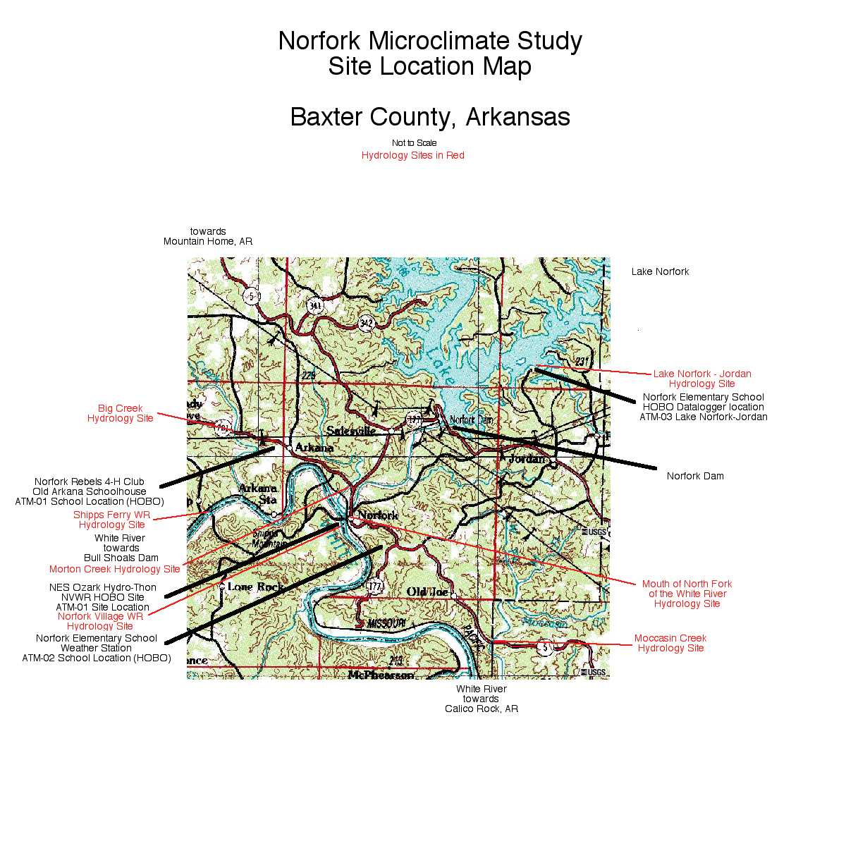
Site names correspond to GLOBE hydrology protocol sites of Norfork
Elementary School and the NES Ozark Hydro-thon
A site map illustrating their location is available
here. (Extract of the USGS Norfork
Quad map, et al.)
UT = Central Daylight Time (CDT) + 5 hours
UT = Central Standard Time (CST) + 6 hours
Test Kit: Lamotte Chloride, Model PSC-DR, quantative titration
|
Site, date, measurement, conductivity |
Site, date, measurement, conductivity |
|
Norfork Village WR, 200309202155, 12 ppm, 290 |
Big Creek @ 201, 200309202230, 44 ppm, 560 |
|
Shipps Ferry Access WR, 200309272230, 12 ppm |
Mouth of Norfork River, 200309202130, 8 ppm, 300 |
|
Cartney Access WR, 200309272130, 8 ppm |
Mouth of Buffalo River, 200309271945, 8 ppm |
|
Buffalo City WR, 200309271900, 12 ppm |
Lake Norfork - Jordan, 200309202015, 8 ppm |
|
** indicates measurements made
during high flow / runoff |
* indicates measurements made
during high flow / runoff * indicates significant road ice melt may have attributed to measured levels of chlorides |
Test Kit: Lamotte Phosphate, Model VM-12, octet-color comparator
|
Site, date, measurement, remarks |
Site, date, measurement, remarks |
|
Norfork Village WR, 200309202155, <1 ppm |
Big Creek @ 201, 200309202230, 3 ppm |
|
Shipps Ferry Access WR, 200309272230, <1 ppm |
Mouth of Norfork River, 200309202130, <1 ppm |
|
Cartney Access WR, 200309272130, <1 ppm |
Mouth of Buffalo River, 200309271945, <1 ppm |
|
Buffalo City WR, 200309271900, <1 ppm |
Lake Norfork - Jordan, 200309202015, <1 ppm |
|
**
indicates measurements made
during high flow / runoff |
* indicates measurements made
during high flow / runoff |